
Cinnamon Bay Trail
This more challenging path climbs from the campground up a shaded ravine toward Centerline Road. In just one mile it gains about 700 feet and connects to the America Hill spur for panoramic views over Francis and Maho bays.
Highlights
Steep climb along an old Danish road through shady forest
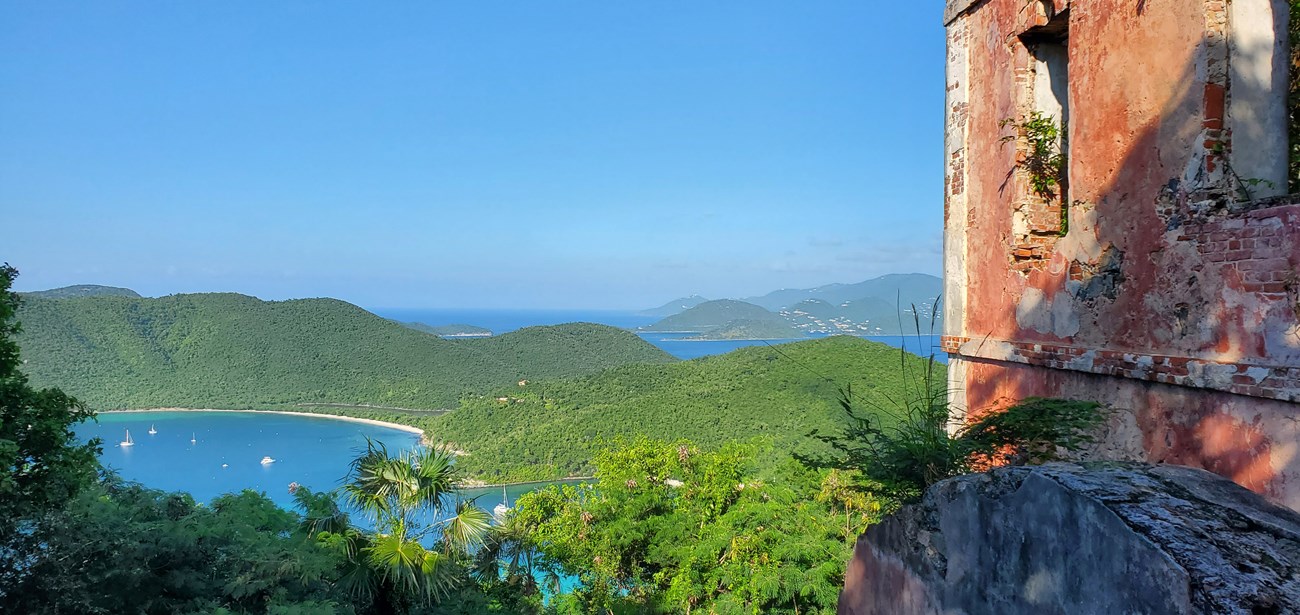
Ruins of the America Hill Great House at the top
Spectacular views of Maho and Francis Bays from the ridge
Optional spur that joins the Centerline Road for longer hikes
Trail statistics
Distance | 1.3 miles out and back |
Elevation change | ~600 ft ascent |
Difficulty | Strenuous |
Trail type | Out and Back |
Estimated time | 1–1.5 hours |
Parking | Cinnamon Bay Beach parking area or along North Shore Road |
Description
The Cinnamon Bay Trail climbs from sea level at Cinnamon Bay Campground to Centerline Road. In just one mile it gains roughly 700 feet, making it a moderately strenuous ascent. The route follows an old Danish road up a shaded ravine lined with golden trumpet trees and tropical hardwoods. About halfway up, a spur branches off to America Hill; this 0.4‑mile side trip climbs steeply to the ruins of a stone house with panoramic views over Francis and Maho bays. Continuing straight, the main trail passes the remnants of estate walls and a few towering kapok trees before meeting Centerline Road. From here, hikers can return the way they came or continue across the island on other trails. Because the ascent is steep but shaded, it’s a good workout even on warm days. The descent requires careful footing on loose stones and tree roots. Early morning hikes are rewarding as the sunlight filters through the canopy and birdsong fills the ravine. Bring water and use insect repellent; after heavy rain the trail can be muddy and slippery.
Distance & Difficulty
1 mi (one way)
Moderate
Trail Map & Gallery

