
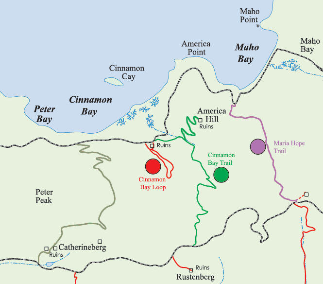
Maria Hope Trail
An historic connector path through lush forest and past ruins, linking Maho Bay and the Reef Bay valley.
Highlights
Old Danish road linking the north and south shore valleys
Shady tropical forest with West Indian locust and bay rum trees
Historic ruins at Paquerau and Estate Hope (great house, horse mill, cistern)
New lower route avoiding private land by switchbacking behind Maho Beach
Trail statistics
Distance | 0.8 miles one way |
Elevation change | Steep sections |
Difficulty | Moderate to Difficult |
Trail type | Connector (point‑to‑point) |
Estimated time | 40–60 minutes |
Parking | Trailheads at Centerline Road and Maho Bay |
Description
The Maria Hope Trail follows a section of an 18th‑century Danish road that once provided passage between Maho Bay and Reef Bay. Today, a 0.8‑mile footpath descends through a shady valley from Centerline Road to either the flats behind Maho Beach or a hairpin turn on the North Shore Road. The upper portion passes the remains of stone walls from an old horse corral and the retaining wall of the historic road; West Indian locust, hog plum and bay rum trees shade the way. A new lower section avoids private land by switchbacking through flat forest behind the beach. The trail also links to spurs leading to Paquerau Ruins and the larger Estate Hope ruins, where you’ll find the remains of a great house, horse mill and cistern. Southbound hikers join the Reef Bay Trail just below the Josie Gut ruins, making Maria Hope a useful connector. Parts of the route, particularly the spur from Bordeaux Mountain Road, are steep, slippery and only semi‑improved, so wear sturdy shoes and carry water.
Distance & Difficulty
0.8 mi (one way)
Difficult
Trail Map & Gallery
